Quantcast
Channel: GeoGarage blog
Viewing all 497 articles
Browse latest View live

NZ Linz update in the Marine GeoGarage

$
0
0
7charts have been updated in the Marine GeoGarage
(Linz November published6 December 2012updates) 

      Today NZ Linz charts (178 charts / 340 including sub-charts) are displayed in the Marine GeoGarage.

      Note :  LINZ produces official nautical charts to aid safe navigation in New    Zealand waters and certain areas of Antarctica and the South-West    Pacific.


      Using charts safely involves keeping them up-to-date using Notices to Mariners

      Online maps switch to 'Algeciras Bay'

      $
      0
      0

       Bing Maps (Yahoo Maps / Nokia)

      From Gibraltar Chronicle

      Spain has long referred to the Bay of Gibraltar as the Bahía de Algeciras, much to Gibraltar’s annoyance.


      But now, in a move that will spark a furious response here in Gibraltar, Madrid appears to have won influential international support for the Spanish version of the name.

      Google Earth view
      Note : not any label on Google Maps

      Two major online map services, Google Earth and Bing maps, have labelled the Bay of Gibraltar as Bahía de Algeciras in their latest updates.

      In a similar development, the latest version of the Encyclopaedia Britannica also refers to the bay as the Bay of Algeciras, even though historical editions named it as Gibraltar Bay.

      It is not clear why all three outlets have chosen to opt for the Spanish name, but the decision comes at a time when Spain is pushing hard to exert influence and jurisdiction in Gibraltar waters.

      The Spanish Government has long referred to the bay as Bahía de Algeciras, in part because of its assertion that the waters around the Rock are Spanish and not British.

      Plano geométrico de la bahía de Algeciras y Gibraltar.
      Levantado por el Brigadier de la Real Armada Vicente Tofiño de San Miguel.
      Director de las Academias de Guardias Marinas. Año 1786.

      But admiralty charts and nautical maps used worldwide refer to the bay by its English name.


      UKHO & IHM Spain nautical map
      >>> geolocalization with the Marine GeoGarage<<<

      NGA 52043 chart (1998) Bay of Gibraltar

       but 'Bahia of Algeciras' is still there in some international nautical chart (INT 3152 / ES445A )
      see SHOM #7026 (2009)

      so the job for the online mapping service leaders is not simple...

      Vendee Globe : Cape Leeuwin

      $
      0
      0
      Saturday 15th 04:00 UTC situation : the two leaders François Gabart and Armel Le Cléac'h
      passed the longitude of SW Australia’s Cape Leeuwin,  the second of the course’s three Great Capes,
      34 days 10h and 23 minutes after the departure, so 2 days 2h and 25 min better than 2004 best time


      >>> geolocalization with the Marine GeoGarage<<<

      Cape Leeuwin is the most south-westerly mainland point of the Australian Continent, in the state of Western Australia.

      In Australia, the Cape is considered the point where the Indian Ocean meets the Southern Ocean.

      Map of Australia (1863), showing the Southern Ocean lying immediately to the south of Australia.
      cropped from Australasia map (National Library of Australia)

       Image showing detail of the National Library of Australia's copy of Hessel Gerritsz' 1627 map of the west coast of Australia
      entitled "Caert van't Landt van d'Eendracht".
      This detail shows a section of coastline discovered by the Leeuwin in 1622,
      and subsequently referred to by the Dutch as 't Landt van de Leeuwin ("The Land of the Leeuwin")

      The Royal Australian Navy's Leeuwin class survey vessel HMAS Leeuwin is named after the cape, which is named after the ship the Leeuwin, a Dutch galleon that charted some of the nearby coastline in 1622.
      The south-west corner of Australia was subsequently referred to by the Dutch as 't Landt van de Leeuwin ("The Land of the Leeuwin") for a time, subsequently shortened to "Leeuwin's Land" by the English.
      This name Leeuwin still survives in the name of Cape Leeuwin, the most south-westerly point of the Australian mainland, so named by Matthew Flinders a distinguished navigator and cartographer, who was the first to circumnavigate Australia and identify it as a continent in December 1801.

      Where the Indian and Southern Oceans meet, stands Cape Leeuwin Lighthouse as a solitary sentinel.
      First lit in 1896 with a range of 26 nautical miles and flashing every 7.5 seconds for .02 of a second.

      Vendée Globe : South East Cape, from Indian to Pacific Ocean

      $
      0
      0
      Situation 18/12 11:00 UTC
      Armel and François crossed the longitude of South East Cape :
      welcome to the Pacific Ocean

      South of Tasmania
      >>> geolocalization with the Marine GeoGarage<<<

      The surface of the planet is approximately 71% water and contains (5) five oceans, including the Arctic, Atlantic, Indian, Pacific and Southern.
      For many years only (4) four oceans were officially recognized, and then in the spring of 2000, the International Hydrographic Organization established the Southern Ocean, and determined its limits.
      (see About.com)
       Those limits include all water below 60 degrees south, and some of it, like the Arctic Ocean, is frozen.

      The question of defining the oceanic limits of the Indian Ocean is complicated and remains unsettled.
      The clearest border and the one most generally agreed upon is that with the Atlantic Ocean, which runs from Cape Agulhas, at the southern tip of Africa, due south along the 20° E meridian to the shores of Antarctica.

       South East Cape

      The border with the Pacific Ocean to the southeast is usually drawn from South East Cape the southernmost point of the main island of Tasmania (the southernmost state of Australia) down the 147° E meridian to Antarctica.

      Bass Strait, between Tasmania and Australia, is considered by some to be part of the Indian Ocean and by others to be part of the Pacific...

      There is no universal agreement on the southern limit of the Indian Ocean.
      In general (and for the purposes of this article), it is defined as extending southward to the coast of Antarctica.
      However, many—notably in Australia—consider the portion closest to Antarctica (along with the corresponding southern extensions of the Atlantic and Pacific) to be part of the Southern (or Antarctic) Ocean.
      Australians often call the entire expanse south of that continent’s south coast the Southern Ocean.

      South East Cape is one of the Five Southernmost Capes that can be rounded by Southern Ocean sailors : Cape of Good Hope (South Africa), Cape Leeuwin (West Australia), South East Cape of Tasmania, South West Cape of New Zealand and Cape Horn (South America).

       The Indian Ocean, according to the CIA The World Factbook (blue area), 
      and as defined by the IHO (black outline - excluding marginal waterbodies)

      Bounded by five continents, the Pacific Ocean is Earth’s largest feature—but it was generally unknown to Europeans until Spanish explorer Vasco Nuñez de Balboa sighted it in 1513 from a peak in Darién, Panama.
      Later, Portuguese explorer Ferdinand Magellan sailed the Pacific on a Spanish expedition of world circumnavigation from 1519 to 1522.
      Magellan called the ocean Pacífico or "Pacific" because he encountered calm seas throughout his journey.

      Maris Pacifici by Ortelius (1589).
      One of the first printed maps to show the Pacific Ocean

      The Pacific Ocean is the largest ocean.
      The Pacific Ocean covers 35% of the earth.
      The Pacific Ocean is almost half of all the oceans, as big as the other four oceans combined.
      As the earth spins around, there is a viewpoint from outer space where all you can see is the Pacific Ocean.

      Links :
      • Princeton : The Pacific Ocean, 250 Years of Maps (1540–1789)
      • GeoGarage blog : Vendee Globe : welcome to the Land of the Albatross

      NOAA Coast Survey cartographers update and maintain over a thousand nautical charts

      $
      0
      0

      From NOAA

      During the first six months of the Coast Survey blog, we have focused largely on the field work – surveying sparsely charted Arctic waters, responding to calls for help following hurricane destruction, finding dangers to navigation, and even identifying historic wrecks.

      We haven’t covered the day-in, day-out job that is our reason for existence: creating and updating the country’s nautical charts.
      Coast Survey has compiled and maintained the nation’s nautical charts for nearly two centuries, after President Thomas Jefferson approved legislation in the Ninth Congress in 1807, and we now maintain a suite of over a thousand charts.

      We sometimes get the question, “aren’t you done yet?”
      Haven’t we finished charting all of the U.S. waters?
      The simple answer is no: because storms alter seafloors, and water depths constantly change due to shifting shoals, submerged hazards, and coastal development, Coast Survey must continually update the nation’s nautical charts.
      Charting those changes, and ensuring chart accuracy and precision, is essential to protecting life and property.

      The more complicated answer may surprise you.
      Many of our nation’s marine shipping lanes, harbors, and port areas haven’t been mapped since the 1920s, when measurements weren’t as precise – or even as accurate ‒ as is possible now.
      Some areas, especially in Alaska, haven’t had bottom measurements since the mid-1770s.

      Coast Survey’s Marine Chart Division employs many of the nation’s best cartographers.
      Since 2009, cartographers have applied approximately 50,000 critical charting corrections to NOAA’s various charting products.
      In fiscal year 2012 alone, cartographers applied more than 11,000 critical corrections to chart updates.

      Over those four years, Coast Survey has also produced over 500 new chart editions (of current charts), and built 200 new NOAA ENC® (NOAA electronic navigational charts).
      This includes 155 new chart editions and 56 new ENCs in fiscal year 2012. 

      Coast Survey issued new Kotzebue chart 16161, partially depicted here, in May 2012.
      >>> geolocalization with the Marine GeoGarage<<<
      see GeoGarage blog 

      This year, Coast Survey produced several brand new nautical charts, including a new chart for the Port of San Juan, Puerto Rico, and for the Kotzebue Harbor in Alaska, where increasing ocean commerce required improved navigational products.
      Coast Survey also released an updated chart of Norfolk Harbor, with a new inset of the Inner Harbor, which has developed as a multi-purpose port area.

      In addition to updating old charts, and creating new ones, Coast Survey is making more information accessible from its electronic navigational charts.
      Effective early 2012, several of NOAA’s ENCs that cover the approaches to the East Coast now alert mariners when they are approaching the right whale seasonal management areas, giving them better information to plan to reduce their speeds or avoid the areas altogether.
      The seasonal management areas, as encoded into the ENCs, graphically show the areas where vessels greater than 65 feet in length must travel at 10 knots or less to reduce the risk of collisions with right whales.
      The ENCs will also provide for an alarm on the ship’s electronic chart display and information system as vessels enter the speed zone, further alerting the bridge watchstander of speed restrictions.

      We are seeing a gradual shift from paper nautical charts to raster navigational charts and electronic navigational charts.
      Over the last four years, the public has purchased nearly 428,000 print-on-demand paper charts, and another 392,000 traditional paper charts.
      Reflecting the booming technology in navigation, the public has downloaded countless millions of the electronic and raster navigational charts that NOAA offers free on the Internet.

      Even while cartographers use their expertise to update and innovate, there is still the matter of uncharted U.S. waters – waters that remain to be surveyed.
      Coast Survey is mandated to provide nautical charts for all U.S. territorial waters and the U.S. Exclusive Economic Zone, a combined area of 3.4 million square nautical miles that extends 200 nautical miles offshore from the nation’s coastline.
      A complete survey of all of those waters would require 545 ship years and $5 billion just to acquire the data.
      Lacking those resources, NOAA has instead established priorities for the hydrographic surveys that acquire data necessary for reliable charts.
      Those priorities are updated annually, and are available on Coast Survey’s website, as NOAA Hydrographic Survey Priorities.

      A critical need for new or updated charts is especially emerging in the Arctic, and Coast Survey’s Arctic Nautical Charting Plan addresses the tasks ahead.
      Commercial mariners and recreational boaters will always rely on NOAA’s charts to keep them and their passengers and cargo safe from harm.
      NOAA’s cartographers will always work to earn that trust.

      If you note a chart discrepancy, please report it through our online service.

      Vendee Globe : crossing the subantarctic islands of New Zealand

      $
      0
      0
      Crossing NZ longitude

      >>> geolocalization with the Marine GeoGarage<<<

      South West Cape
      >>> geolocalization with the Marine GeoGarage<<<

      South West Cape is a cape on the south coast of Stewart Island, New Zealand.
      It is the southernmost point on the island, and as such is almost the southernmost point on the main chain of islands that make up New Zealand,
      beaten to that honour by the tiny Murphy Island, which lies some three kilometres to the west and some 100 m further south. 


      Stewart Island (NZL) 11th-17th January 2001(Port Pegasus)- Vendée Globe 2000/2001.
      "Aquitaine Innovation" arriving in Port Pagasus, with a broken mast !
      >>> geolocalization with the Marine GeoGarage<<<
      Yves Parlier (FRA) Open 60' skipper "Aquitaine Innovations" in Steward Island fixing his broken mast on his own without assistance respecting Race rule.
       Yves finished his round the world with his mast fixed in Stewart Island. 
      ©Thierry Martinez / Sea&Co


       The Western Chain

      The New Zealand Sub-Antarctic Islands has five island groups (the Snares, Bounty Islands, Antipodes Islands, Auckland Islands and Campbell Island) in the Southern Ocean south-east of New Zealand, occupying the stormy latitudes of the Roaring Forties and the Furious Fifties, known also as the Albatross Latitudes.
      The islands situated between the Antarctic and Subtropical Convergences and the seas, have a high level of productivity, biodiversity, wildlife population densities and endemism among birds, plants and invertebrates.
      They are particularly important resident for the large number of pelagic seabirds and penguins that nest there.
      There are 126 bird species in total, including 40 seabirds of which five breed nowhere else in the world.


      The New Zealand Sub-Antarctic Islands shows a pattern of immigration of species, diversification and emergent endemism, provides particularly good opportunities for research into the dynamics of island ecology.
      The New Zealand Sub-Antarctic Islands are remarkable for their high level of biodiversity, population densities, and for endemism in birds, plants and invertebrates.
      The bird and plant life, especially the endemic albatrosses, cormorants, petrels, shearwaters, fulmars, prions -and “megaherbs” are unique to the islands.
      Penguins too, are special in the Sub Antarctic region. 
      Of seven penguin species breeding here, three (Snares crested, Erect crested and Royal) are endemic to the region.
      The land birds indicate, through their diversity, just how long these islands have been isolated.

      North East Island, NZ
      >>> geolocalization with the Marine GeoGarage<<<
      The North East Island is the main island of the Snares Island group, approximately 200 kilometres (120 mi) south of New Zealand's South Island.
      The island forms a central triangle with peninsulas to the north, south and to the west and is some 3 by 2.5 km (1.9 by 1.6 mi) long by wide. Off the South Promontory lies Broughton Island, the second largest island in the group. South off the western peninsula coast lies the islet Alert Stack and off the North Promontory lies the North and South Daption Rocks.
      The highest elevation of 130 m (427 ft) is at the western peninsula.

      The southwest part of North East Island, Snares Islands, where the coastline is oriented to the northwest, showing the rocky cliffs that are typical of much of the south, west and north coasts exposed to prevailing westerly storms.
      Photo Copyright © 2004 Tui De Roy, Roving Tortoise Worldwide Nature Photos

      >>> geolocalization with the Marine GeoGarage<<<
      The Bounty Islands are a small group of 13 uninhabited granite islets and numerous rocks in the south Pacific Ocean that are territorially part of New Zealand. It lies about 670 km (416 mi) east-south-east of the South Island of New Zealand, and 530 km south-west of the Chatham Islands.
      The Bounty Islands were discovered by Captain William Bligh in 1788 and named after his ship, HMS Bounty, just months before the famous mutiny.
      During the 19th century, they were a popular hunting ground for sealers.

       The Bounty Islands are literally rocks in the ocean.

      >>> geolocalization with the Marine GeoGarage<<<
      The Antipodes Islands are inhospitable volcanic islands to the south of—and territorially part of—New Zealand. They lie 860 kilometres (534 mi) to the southeast of Stewart Island/Rakiura

      View from the Antipodes

      Auckland islands
      >>> geolocalization with the Marine GeoGarage<<<
      The Auckland Islands are an archipelago of the New Zealand subantarctic islands and include Auckland Island, Adams Island, Enderby Island, Disappointment Island, Ewing Island, Rose Island, Dundas Island and Green Island.
      They lie 465 kilometres (290 mi) from the South Island port of Bluff.
      The islands have no permanent human inhabitants.

      Photo : Andris Apse
      (other photos of Auckland islands)

      "During my second Vendée Globe, I thought of stopping on the Auckland Islands south of New Zealand, however, this is not easy to do in an Open 60. I said to myself that the JP 54 would have to be able to anchor in a bay or set off again in less than 10 minutes. The pleasure of sailing comes with the ease with which you can discover a place.” Jean-Pierre Dick (31/12/2008)
       
      Campbell Island 
      >>> geolocalization with the Marine GeoGarage<<<
       Campbell Island is a remote, uninhabited, subantarctic island of New Zealand and the main island of the Campbell Island group.
      The island is surrounded by numerous stacks, rocks and islets like Dent Island, Folly Island, Isle de Jeanette Marie, and Jacquemart Island, the latter being the southernmost extremity of New Zealand.
      The Island is mountainous, rising to over 500 metres (1,640 ft) in the south.
      A long fjord, Perseverance Harbour, nearly bisects it, opening out to sea on the east coast.

      Landscape, Campbell Island with Jacquemart Island in the background.
       
      Macquarie Island
      >>> geolocalization with the Marine GeoGarage<<<
      Macquarie Island (or Macca) lies in the southwest corner of the Pacific Ocean, about half-way between New Zealand and Antarctica.
      About 1500 km south east of Tasmania, Macquarie Island is a tiny fragment of land between Tasmania and Antarctica in the Southern Ocean.

      Politically, it is part of Tasmania, Australia since 1900 and became a Tasmanian State Reserve in 1978.
      In 1997 it became a World Heritage Site.

      The island is home to the entire Royal Penguin population on earth during their annual nesting season.
      Ecologically, it is part of the Antipodes Subantarctic Islands tundra ecoregion.

      Vendee Globe : crossing the antimeridian (the 180th degree meridian)

      $
      0
      0
      Situation 21/12/2012 19:00 UTC
      The two leaders crossed the antimeridian.

      >>> geolocalization with the Marine GeoGarage<<<<
      Mercator projection presents the meridians by vertical straight lines

      With info from V&V& wikipedia

      Points with the same longitude lie in lines running from the North Pole to the South Pole.

      By convention, one of these, the Prime Meridian, which passes through the Royal Observatory, Greenwich, England, establishes the position of zero degrees longitude.
      The longitude of other places is measured as an angle east or west from the Prime Meridian, ranging from 0° at the Prime Meridian to +180° eastward and −180° westward.

      The United Kingdom and its former colonies established the Royal Observatory at Greenwich just outside of downtown London in 1675.
      This national observatory was established as the starting location for longitude or the y-axis for the British coordinate system.

      Since the United Kingdom was a major colonial power and a major navigational power of the eighteenth and nineteenth centuries, their maps and navigational charts with the prime meridian passing through Greenwich were promulgated and many other countries adopted Greenwich as their prime meridians.
      Britain had more shipping and ships using the Greenwich Meridian than the rest of the world put together (at the time) : the British Nautical Almanac started these charts in 1767.

      By 1884, international travel was commonplace and the need for a standardized prime meridian became readily apparent.
      Forty-one delegates from twenty-five "nations" met in Washington D.C. for a conference to establish zero degrees longitude and the prime meridian.

      Greenwich was selected as the prime meridian by a vote of twenty-two in favor, one against (Haiti), and two abstentions (France and Brazil).
      By the time of the conference, the United Kingdom and its colonies as well as the United States of America had already begun using Greenwich as the prime meridian; this weighed heavily on the selection process.


      The 180th meridian or antimeridian is the meridian which is 180° east or west of the Prime Meridian with which it forms a great circle.
      An Anti-Meridian is a meridian opposite any given meridian of longitude : so specifically the Anti-Meridian is the 180th meridian (tthe meridian opposite of the Prime Meridian)
      It is common to both east longitude and west longitude.


      Longitude is given as an angular measurement ranging from 0° at the Prime Meridian to +180° eastward and −180° westward.
      The Greek letter λ (lambda), is used to denote the location of a place on Earth east or west of the Prime Meridian.

      With the establishment of the prime meridian and zero degrees longitude at Greenwich, the 1884 Washington conference also established time zones. (report)
      By establishing the prime meridian and zero degrees longitude in Greenwich, the world was then divided into 24 time zones (since the earth takes 24 hours to revolve on its axis) and thus each time zone was established every fifteen degrees of longitude, for a total of 360 degrees in a circle.
      So, it is used as the basis for the International Date Line because it for the most part passes through the open waters of the Pacific Ocean.
      However, the meridian passes through Russia and Fiji as well as Antarctica.

      Longitude at a point may be determined by calculating the time difference between that at its location and Coordinated Universal Time (UTC).
      Since there are 24 hours in a day and 360 degrees in a circle, the sun moves across the sky at a rate of 15 degrees per hour (360°/24 hours = 15° per hour).
      So if the time zone a person is in is three hours ahead of UTC then that person is near 45° longitude (3 hours × 15° per hour = 45°).
      The word near was used because the point might not be at the center of the time zone; also the time zones are defined politically, so their centers and boundaries often do not lie on meridians at multiples of 15°.
      In order to perform this calculation, however, a person needs to have a chronometer (watch) set to UTC and needs to determine local time by solar or astronomical observation.
      The details are more complex than described here: see the articles on Universal Time and on the equation of time for more details.

      The International Date Line is linked to the antemeridian.
      The advantage of having the Prime meridian in Europe is to get an Antimeridian crossing on a North/South axis the largest liquid desert in the world, the Pacific Ocean so without disturbing a lot of people.

       >>> geolocalization with the Marine GeoGarage<<<

      >>> geolocalization with the Marine GeoGarage<<<

      Line date change diverges from the antemeridian being shifted eastward between 5° S and 51°20 'S to leave in the same time zone New Zealand's Chatham Islands in the east and far north-east, the Kermadec Islands (whose name is issued from Jean-Michel Huon de Kermadec who commanded the Espérance on the Bruni d'Entrecasteaux expedition to find the lost expedition of Jean-François de La Pérouse).

      This difference does not affect the Vendée Globe racers who have both sailed south of the latitude 51° 20'S when they reach the Antimeridian (around 53° S).

      The establishment of the prime meridian in Greenwich in 1884 permanently established the system of latitude and longitude and time zones that we use to this day.
      Latitude and longitude is used in GPS and is the primary coordinate system for navigation on the planet.
      Right now, Armel and François the two VG leaders have seen the longitude stop increasing to 180° (E) to decrease from 180° (W) : they really are into the second part of the race right now and on the road back – theoretically. The reality is they will sail to home 12,000 miles more...

      Note : the term Anti-Meridian is sometimes confused with Ante Meridiem.
      Ante Meridiem is latin for before noon.Usually shown in English as "a.m.".
      Similarly, post meridiem, after noon, is shown in English as "p.m.".
       
       The map of the world showing Magellan's Route
      (view in high resolution with the BNF)

      Şekl-i Amerika (America), Ottaman Empire
      The map of America, also called The New World, covers the region between the 60 degree parallels in the north and south.
      The lines of latitude and longitude are drawn intersecting at right angles in the manner of Mercator.

      Links :

      Vendee Globe : Enderby island on Auckland island : shelter for Bernard Stamm

      $
      0
      0
      Enderby island in the North of Auckland Island
      (Plans in the Auckland Islands: Enderby Island to Smith Harbour Linz NZ2862)
      >>> geolocalization with the Marine GeoGarage<<<

      Lying in fifth place in the Vendee Globe Bernard Stamm has stopped Cheminees Poujoulat in the Auckland Islands to the south of New Zealand in order to effect repairs to his hydro generators.
      He then intends to continue.
      Stamm stopped on the sheltered side of island late afternoon yesterday (UTC).
      After struggling to find a protected spot, Stamm is ended up moored in Sandy Bay, on the side of south of Enderby Island, to the northeast of the main Auckland island. (Vendee Globe info)

       Worsley, Charles Nathaniel : Enderby Island, Ross Harbour, Auckland Islands. [Jan. 1902]

      This has offered him protection from the 25 knot northwest wind.
      He has reported sightings of whales and sea lions.
      The islands represented the last possibility of shelter before Cape Horn, 4,000 miles away.

       Hooker's Sealions - Sandy Bay, Enderby Island
      Upper Auckland Islands showing Sandy Bay breeding colony, Enderby Island
      and Dundas Island, the largest breeding area for NZ sea lions.
      by markfountain52

      (other photo of Graham Martin on Panoramio)

      Samuel Enderby& Sons was one of the most prominent English sealing and whaling firms, active in both the Arctic and Southern Oceans. 
      Also in 1830, Charles became a founding member of the Royal Geographical Society (RGS).
      Charles encouraged masters of Enderby vessels to report geographical discoveries and had notable successes with John Biscoe and John Balleny, who between them discovered Enderby Land, Graham Land, the Balleny Islands and the Sabrina Coast.
      Another Enderby captain, Abraham Bristow, discovered the Auckland Islands in 1806, naming one of the islands Enderby Island.

      Shipwrecks have always been an unfortunate part of New Zealand’s maritime heritage.
      For the castaways marooned on offshore islands, particularly in the subantarctic, life was a very grim prospect.
      Apart from the trauma of shipwreck, once the basics of food, shelter and fire had been secured, and discipline and social organisation established, there was the dreadful prospect that castaways might never be rescued.
      New Zealand’s subantarctic island groups lie in a semicircle to the south and south-east, and many ships that strayed into their path have been wrecked.
      The islands lie on the Great Circle Route, which was used by sailing ships leaving the southern Australasian ports for Europe.
      The ships dropped down into the Southern Ocean to take advantage of the prevailing westerly winds, which blew uninterrupted on the way around Cape Horn.

      Wreckage and the figurehead of the 'Derry Castle' wrecked on Enderby Island, Auckland Islands. Photographed on 22nd March 1887 by an unidentified photographer; copy negative with inscription by David Alexander De Maus.
      The figurehead can now be viewed at the Canterbury Museum in Christchurch, New Zealand.
      The reef where she ran aground is called "Derry Castle Reef" and the bay this reef is in, is called "Bones Bay".

      The Derry Castle, on a voyage from Geelong to Falmouth, was wrecked on this rocky northern coast of Enderby Island on 20 March 1887.
      Fifteen drowned, but eight reached Enderby Island and eventually built a punt, which they sailed to Auckland Island and its provision depot. The survivors were rescued in June. (see link)

      This cover is from the 1880 edition of Wrecked on a reef (or Twenty months on the Auckland Islands)
      which was republished in New Zealand in 2003.
      François-Erdouard Raynal’s epic account of the wreck of the Grafton and the five castaways’ survival on Auckland Island
      helped make castaway stories important in maritime folklore.
      Raynal’s account, first published in French in 1870 and in English in 1874, was used by Jules Verne for his book Mysterious island.

      Links :

      NOAA warns large ships to avoid sanctuary

      $
      0
      0
      >>> geolocalization with the Marine GeoGarage<<<

      "...here there is no place to land on from out of the grey water. For without are sharp crags, and round them the wave roars surging, and sheer the smooth rock rises, and the sea is deep thereby, so that in no wise may I find firm foothold and escape my bane, for as I fain would go ashore, the great wave may haply snatch and dash me on the jagged rock - and a wretched endeavour that would be."
      - Homer, The Odyssey


      The National Oceanic and Atmospheric Administration is asking ships of 400 gross tons or greater to stay farther away voluntarily from part of the Olympic Coast National Marine Sanctuary when traveling along the coast to protect the area from possible oil spills.

      The “area to be avoided,” known as an ATBA, extends as far as 25 nautical miles (28.7 miles) west of the coast from Tatoosh Island at the north to Pacific Beach State Park to the south.

      It was developed by NOAA and the Coast Guard when the sanctuary — which includes 2,408 square nautical miles (2,771 square miles) of marine waters off the Olympic Peninsula Pacific Coast — was established in 1994 to reduce the risk of a shipwreck and resulting pollution to the sanctuary.

      The ATBA has been marked on nautical charts since then, and vessels greater than 1,600 gross tons were asked to avoid the area.

      Since Dec. 1, smaller ships also have been asked to find another route to travel south in the Pacific Ocean from the mouth of the Strait of Juan de Fuca.

      “The consequences of an oil spill can be devastating to the environment and regional economy, and the maritime industry recognizes that supporting such precautions is good for their business as well as the environment,” said Carol Bernthal, superintendent of NOAA’s Olympic Coast National Marine Sanctuary, which is based in Port Angeles.

      In the years since the ATBA was adopted, 99 percent of the nearly 9,000 ships that pass through the region annually have complied with the boundaries, said George Galasso, assistant sanctuary superintendent.

      Ships greater than 400 gross tons are required to prepare oil spill response plans because of the large amounts of fuel they carry, Galasso said.
      Most of that oil is for their own use, such as fuel oil for propulsion, but is enough to damage the sanctuary in the event of a wreck.

      According to the new rules, the voluntary avoidance area does not apply to fishing vessels, research vessels and naval ships that are taking part in activities allowed in the area.

      The International Maritime Organization adopted the revised ATBA for charts used by the international shipping industry, while the Coast Guard is working with NOAA to have these changes added to nautical charts and included in the U.S. Coast Pilot.

      Compliance with the ATBA will be monitored by the sanctuary and the U.S. and Canadian coast guards, which work together to manage the shipping lanes in the Strait of Juan de Fuca, which is dissected by the international border.

      The sanctuary, in cooperation with the U.S. Coast Guard, will continue an education and outreach campaign to the maritime industry, distributing informational charts and informing ship owners when their vessels enter the area, Galasso said.

      Round-world yachtsman declines help

      $
      0
      0
      situation 08:00 UTC

      >>> geolocalization with the Marine GeoGarage<<<


      A stricken yacht has anchored off the coast of Dunedin to make emergency repairs after being damaged during one of the world's most gruelling round-the-world solo yacht races.
      Swiss sailor Bernard Stamm first attempted to make repairs to the hydro-generator and the central winch column on his yacht Cheminees Poujoulat in the Auckland Islands last week while racing towards Cape Horn, South America.

      But finding a suitable place to anchor in a sheltered bay away from kelp beds and other seaweed proved too difficult.
      So he headed for New Zealand, and anchored near Murdering Beach yesterday.

       Swiss yachtsman Bernard Stamm stands on the stern of Cheminees Poujoulat off Murdering Beach, near Dunedin, waiting for the swell to subside so he can make repairs to his hydro-generator before returning to the Vendee Globe 2012 round-the-world yacht race.

      The vessel's 19m-long, 6m-wide hull could not be sailed into Otago Harbour because it needs deep keel clearance.

      Mr Stamm was interviewed and photographed from a small boat yesterday afternoon after a friend emailed the Otago Daily Times about his plight.
      He said the long sail north was a major detour in his bid to win the Vendee Globe 2012 round-the-world yacht race.
      The non-stop race, known as the ''Everest of the Seas'', begins in Les Sables d'Olonne, France, and heads east via the capes of Good Hope, Leeuwin and Horn before heading back to the finish in Les Sables d'Olonne.

       Kaikai's Beach, Murdering Beach
      The bay south of Whare ake ake is called Kaikai after a Ngati Mamoe man dwelling there in a cave in the early days.
      The proper name is Takeratawhai.
      The cave belonging to Kaikai is now used as a sheep pen.
      A heavy "tapu" rested on Murdering Beach until it was lifted by a North Island tohunga at the request of the Purakaunui Maoris.
      The three bays south of Purakaunui have been the happy hunting-grounds of curio collectors, alas many not venerating the burial-places.
      It has been estimated that 3½ tons of worked greenstone has been recovered.

      Mr Stamm said he was leading the race when one of the brackets securing the hydro-generator on the hull failed.

      The system uses motion through water to generate electricity, and without it, he does not have enough energy to power appliances such as lights, pumps, computers, navigation and automatic piloting equipment.

      Mr Stamm said he was taking care to avoid physical contact with any other vessels for fear of breaking race rules, which state competitors will be disqualified if they receive help or equipment during the race.

       photo : Sophie Luther

      While in the Auckland Islands, a Russian ship came alongside and offered fuel, but he rejected the offer because he was determined to continue the race.

      He said it was a difficult choice, but he was guided by his ''sense of responsibility''.

      Mr Stamm said he had been at sea since November 10, and at an average speed of 14 knots, he still had about 40 days to go before he crossed the finish line.

      When asked if he had had a shower since his departure, he shook his head and pointed to the sea before making scrubbing motions.

      He often dreamed of having a cold beer.
      He said: ''A beer would be nice now, but it would taste better at the end.''

      Being at sea alone was lonely at times, but he was grateful he could communicate via his laptop with his wife and two children.

      However, the damaged hydro-generator meant he has had to cut back on the amount of communication with his family.
      He was looking forward to finishing the repairs so he could make contact with them more often.
      He hoped to be back on the high seas some time today, he said.

      Although Mr Stamm was only about halfway through the race, he said he was now more than 3500km behind the race leader and it was unlikely he could still win.

      In his previous attempt at the Vendee Globe race, he had to retire due to damage, so this year's race was now more about getting to the finish, he said.

      NZ Linz update in the Marine GeoGarage

      $
      0
      0
      10charts have been updated in the Marine GeoGarage
      (Linz December published20 December 2012updates) 

      • NZ23New Zealand, North Island
      • NZ25New Zealand, South Island
      • NZ63Kaikoura Peninsula to Banks Peninsula
      • NZ64Banks Peninsula to Otago Peninsula
      • NZ632Banks Peninsula
      • NZ5314Mercury Islands
      • NZ5318Great Mercury Island / Ahuahu to Otara Bay
      • NZ6321Lyttelton Harbour / Whakaraupo: Port of Lyttelton
      • NZ14600New Zealand including Norfolk and Campbell Island / Motu Ihupuku
      • NZ14601Tasman Sea, New Zealand to S.E. Australia
          Today NZ Linz charts (178 charts / 340 including sub-charts) are displayed in the Marine GeoGarage.

          Note :  LINZ produces official nautical charts to aid safe navigation in New    Zealand waters and certain areas of Antarctica and the South-West    Pacific.


          Using charts safely involves keeping them up-to-date using Notices to Mariners

          Vendee Globe : Cape Horn and ice danger

          $
          0
          0
          A tour of Cape Horn with Sir Robin Knox-Johnston
          Extracts from a magnificent one hour BBC 2 documentary of Sir Robin Knox-Johnston and Skip Novak, owner of yacht Pelagic, sailing from the Beagle Channel to Cape Horn and then landing on the notorious rock. As crew he takes Sir Ranulph Fiennes and John Simpson


           >>> geolocalization with the Marine GeoGarage<<<

          Cape Horn remains a maritime legend to this day, as sailing around this remote point and then through the Drake Passage was (and is) one of the most challenging nautical routes on the planet.
           The violent stretch of chaotic water between Antarctica and South America, one frequented by icebergs, huge waves and plagued by gale-force winds, is crossed by sailors with great trepidation.

          Many still prefer to use the sheltered Strait of Magellan.
          (photo in high resolution)

          At this spot the Atlantic and Pacific oceans meet, often in a confrontation.
          No land to the east, none to the west—winds sweep all the way around the world from the west.
          The closest arm of Antarctica, Graham Land of the Antarctic Peninsula, lies six hundred miles to the south across the roughest stretch of water known on the planet, Drake Passage.
          Since its discovery by the Dutch mariners Jacob Le Maire and Willem Corneliszoon Schouten in 1616, Cape Horn has become known as the graveyard of ships.


          Its precise geographical location is the southern headland of Horn Island, Chile, in the Tierra del Fuego archipelago at the bottom of South America.
          As ships got larger, they could not navigate the Magellan Strait and had to risk “rounding the Horn,” a phrase that has acquired almost mythical status.
          For most mariners, it means sailing windward, from the Atlantic to the Pacific, fighting winds, waves, and currents, for sailing with the wind is strategically simpler and carries no bragging rights.

          Cape Horn lore is extensive, full of fear and fascination—summed up in the sailor’s motto “below 40 South there is no law, below 50 South there is no God.”
          Over the past four hundred years, the Horn’s cold, tempestuous waters have claimed more than one thousand ships and fifteen thousand lives.

          Description of the new route to the South of the Strait of Magellan discovered
          and set in the year 1616 by Dutchman Willem Schouten from Hoorn (1619)

          Even successful passage has often exacted a toll.
          For example, British Admiral George Anson’s 1741 mission to attack Spanish possessions on the west coast of South America took three months to pass Cape Horn; of his six warships, two failed to round the Horn and went home, and one was wrecked on the coast of Chile.


          Bounty rounds Cape Horn
          As we gaze though nature’s sunny smile we see her teeth fully barred ... and, as any sailor will testify ‘to be at the mercy of the sea and to survive is to be born again.’
          So is the purpose of this work using warm darks to indicate the infinite depths of the southern ocean - and warm greens show the hopelessness of the situation as the waves rush up to block the light. 
          (John Hagan's classic 'Bounty' paintings)

          Captain William Bligh on the HMS Bounty tried for a month in 1788 to round the Horn on his way to Tahiti, but adverse weather forced him to turn around and take the longer route east past Africa and India instead.
          Since the opening of the Panama Canal in 1914, there has been no need for most commercial ships to run the risk anymore, though adventuring sailors and yacht racing enthusiasts continue to test their luck.

          zoom view with SHN chart
          Cape Horn, Spanish Cabo de Hornos,  steep rocky headland on Hornos Island, Tierra del Fuego Archipelago, southern Chile.
          Located off the southern tip of mainland South America, it was named Hoorn for the birthplace of the Dutch navigator Willem Corneliszoon Schouten, who rounded it in 1616.
          False Cape Horn (Falso Cabo de Hornos), on Hoste Island, 35 miles (56 km) northwest, is sometimes mistaken for it.
          Navigation in the rough waters around the cape is hazardous, with a windy and cold year-round climate.


          Cabo de Hornos (SHOA detail map)

          The lighthouse and sculpture viewed from the south - ie,e while rounding the Horn
          (photo GrahamAndDairne)
           In 1992, on a hilltop at the East of Horn Island, a monument to the memory of the mariners lost in the waters off Cape Horn was erected, financed with both public and private funds from Chile and many other countries.
          The interior outline of its facing steel sheets form the image of a wandering albatross in flight; a nearby marble plaque is inscribed with a Spanish poem by Chilean Sara Vial

          Routes between Strait of Magellan (Estrecho de Magallanes) and Cabo de Hornos
          (source Directmar)

          Ice has been monitored well to the north and east of Drake’s Passage for much of December.
          When the leaders are due to round there are expected to be 15 relatively small icebergs to the south and east of Cape Horn at a radius of about 50 miles.

           NGA 29002 (Antarctic Peninsula)
          Is Cabo de Hornos the southernmost point of South America?
          No, the  – Islas Diego Ramirez– approx. 60 miles southwest of Cape Horn,
          is the southernmost point of South America.
          >>> geolocalization with the Marine GeoGarage<<<
          The southernmost point of the mainland lays several hundreds of miles north, 
          on the peninsula Brunswick, near Punta Arenas.

          Expected at Cape Horn on the first day of 2013 Tuesday January 1st,  the two Vendée Globe leaders Francois Gabart and Armel Le Cléac’h might be able to look forward to relatively clement, settled weather for their passage but they will have another critical variable set to challenge them as they round the notorious point.


          The ice is reckoned to be drifting away at a rate of around 20 miles per day which, suggests Race Director Denis Horeau, means the problem is most serious for the first boats.

          Horeau told Vendée Globe LIVE :
          “CLS our partner have seen by satellite that there is ice drifting in the south and east of Cape Horn, but of course the problem is that the satellites can only see some of the ice and not all of it. So far we can only see by satellite ice which is at least 100 metres long. And so long as we know that there is ice of 100 metres long approximately then you can be sure that there will be some smaller bergs around. So that is our problem.”
          “ The choice is now with the skippers. We will inform them every day of the situation, what we can see with the satellites and what the drift is expected to be. So we will provide them with a report every day in order that they can understand the situation as well as we can see it. The problem is that we cant know the situation exactly.”
          “ Putting an ice gate closer to the Cape could only be to the south if it but the ice is drifting to the east at a rate of something like 20 miles per day. So we think most will have passed to the East by the time the majority of skipper are arriving. We hope this problem will only be for the first boats. Putting a gate positioned for the first boats would be unfair for the others. So that is not the way to do it. We make the rules on the Vendée Globe for all the boats.”
          “ We had ice in past editions. We have not had this amount of ice at Cape Horn before, we had ice in 2008, but it was to the west of Cape Horn and so we lifted the Pacific East gate north by 400 miles to the north. We had a lot of ice in the east of the Pacific this time. It is difficult to say if it is related to the warming of the planet, but what we do know is that we can see more than before.”

          Photo courtesy of the Chilean Navy showing a drifting iceberg than 200 meters in diameter and ten feet high about 300 kilometers from Puerto Williams, in Cape Horn.
          EFE / Armada de Chile (30 Nov 2012)

          The bergs which are seen by the satellites are between 100m and 400m long, but the problem for the skippers is the smaller sections which almost certainly exist, some of which will be semi-submerged.
          By comparison there were significant levels of ice in the East Pacific during the last edition in 2008-9, much of it well before the longitude of Cape Horn
          Then, the Pacific East gate was moved more than 400 miles to the north to keep the fleet as clear of danger as possible.

          Links :

          Vendee Globe : South Atlantic Ocean islands

          $
          0
          0
          situation 02/01/2013 04:00 UTC

          >>> geolocalization with the Marine GeoGarage<<<

          Isla de los Estados (English: Staten Island, from the Dutch Stateneiland) is an Argentine island that lies 29 kilometres (18 mi) off the eastern extremity of the Argentine portion of Tierra del Fuego, from which it is separated by the Le Maire Strait.
          It was named for the Netherlands States-General, and its original Dutch name was identical to that of the New York borough of Staten Island.

           San Juan de Salvamento lighthouse on the east coast of the remote Isla de los Estados,
          made famous by Jules Verne in the novel The Lighthouse at the End of the World
          The remains of the original lighthouse were moved to Ushuaia and a reconstruction of the lighthouse was finished at the museum in 1997.
          At the original site a reproduction of the lighthouse was created in 1998
          by a society of French fans of Jules Verne who worked with the Argentine Navy.
          This reproduction is now an active aid to navigation.

          Falkland Islands (above) UKHO / Islas Malvinas (below) SHN
          >>> geolocalization with the Marine GeoGarage<<<

          The Falkland Islands (Spanish: Islas Malvinas) are an archipelago located in the South Atlantic Ocean on the Patagonian Shelf.
          The principal islands are about 310 miles (500 kilometres) east of the Patagoinian coast at a latitude of about 52°S.
          The archipelago which has an area of 4,700 square miles (12,173 square kilometres) comprises East Falkland, West Falklandand 776 smaller islands.
          The islands, a British Overseas Territory, enjoy a large degree of internal self-government with the United Kingdom guaranteeing good government and taking responsibility for their defence and foreign affairs.


          Controversy exists over the Falklands' original discovery and subsequent colonisation by Europeans. At various times there have been French, British, Spanish, and Argentine settlements. Britain re-established its rule in 1833, though the islands continue to be claimed by Argentina.
          In 1982, following Argentina's invasion of the islands, the two-month-long undeclared Falklands War between both countries resulted in the surrender of all Argentine forces and the return of the islands to British administration.

          Oil exploration, licensed by the Falkland Islands Government, remains controversial as a result of maritime disputes with Argentina.

           German map from 1844, hence the number of German terms appearing on it.
          Most of the French names have disappeared leaving mainly English names with a few Spanish ones.
          Port Egmont is still marked on the map.
          This map divides the islands up into East and a West Falkland Island.
          This map credits the discovery of the islands to Davis in 1592.

          A map showing the Falkland Islands prior to 1794 with marginal notes describing the division of the Islands between British West Falkland and Spanish East Falkland.
          Part of a "Map of South America containing Terra-Firma, Guayana, New Granada, Amazonia, Brasil, Peru, Paraguay, Chaco, Tucuman, Chili and Patagonia with a chart of Falkland's Islands named by the French Malouine Islands and discovered by Hawkins in the year 1593.

          South Georgia and the South Sandwich Islands
          South Georgia (above) UKHO / Isla San Pedro (below) SHN
           >>> geolocalization with the Marine GeoGarage<<<


          South Georgia and the South Sandwich Islands (SGSSI) is a British overseas territory in the southern Atlantic Ocean.
          It is a remote and inhospitable collection of islands, consisting of South Georgia and a chain of smaller islands, known as the South Sandwich Islands.
          The United Kingdom claimed sovereignty over South Georgia in 1775 and the South Sandwich Islands in 1908. In 1908 the United Kingdom annexed both South Georgia and the South Sandwich Islands.
          Argentina continues to claim sovereignty over South Georgia and the South Sandwich Island.

           Capt. Isaac Pendleton, South Georgia (1802);
          Southatlantic Ocean: Discovered by the Frenchman La Roche in the year 1675.

          NOAA chart reveals underwater hazard for proposed anchorage area

          $
          0
          0
          >>> geolocalization with the Marine GeoGarage<<<

          From NOAA

          Similar to a road map, nautical charts provide basic navigation information for mariners – such as water depths and the locations of hazards – to support safe navigation. 

          Cartographers from NOAA’s Office of Coast Survey recently flagged a potentially dangerous situation during their review of a proposed federal rule establishing new anchorage areas on the Mississippi River.

          The proposed anchorage areas were based on non-NOAA charts that did not depict the underwater pipelines.
          The pipelines, which carry benzene, posed a potential danger if ships dropped anchor on top of them.

          The pipeline areas are depicted on the NOAA nautical chart (#11370 Mississippi River-New Orleans to Baton Rouge 1:40,000)
          That chart data and original source files led to the cancellation of the proposed anchorage area.

          The Office of Coast Survey is the US nation's nautical chart maker, providing traditional paper charts as well as the charts used by commercial electronic navigational systems.
          The suite of nearly a thousand nautical charts covers 95,000 miles of U.S. coastline.

          Brazil DHN update in the Marine GeoGarage

          $
          0
          0

          23 charts have been added since the last update :
          (DHN update January 4, 2013)

          • 3335      DO RIACHO GUAICURUS À ILHA SANTA MARIA
          • 3339      DA ILHA CAMBÁ NUPÁ À ILHA JOSÉ KIRÁ
          • 3342      DE FORTE OLIMPO AO PASSO CURUÇU CANCHA
          • 3344      DA ILHA DO RABO DA EMA À ILHA DO ALGODOAL
          • 3345      DA ILHA DO ALGODOAL À VOLTA RÁPIDA
          • 3346      DA VOLTA RÁPIDA À ILHA DO CHAPÉU
          • 3347      DA ILHA PORTO NOVO À ILHA CAPÃO QUEIMADO
          • 3348      DO PUERTO ESPERANZA À ILHA CABEÇA DE BOI
          • 3349      DA ILHA SEPUTÁ À FOZ DO RIO NEGRO
          • 3350      DA FOZ DO RIO NEGRO À ISLA PATATIVA
          • 3351      DA ILHA SANTA FÉ AO PASSO REBOJO GRANDE
          • 3352      DO PASSO DO REBOJO GRANDE À ILHA DO MARCO
          • 3353      DO ESTIRÃO DE COIMBRA À ILHA PARATUDAL
          • 3354      DO PASSO PIÚVA INFERIOR À ILHA DOS BUGRES
          • 3355      DA ILHA DOS BUGRES À ILHA NABILEQUE
          • 3356      DO PASSO DO CONSELHO À VOLTA DO ACURIZAL
          • 3357      DA VOLTA DO ACURIZAL AO RIACHO DO ABRIGO
          • 3358      DA ORÇADA DE SÃO JOSÉ À ILHA CARAGUATÁ
          • 3359      DA ILHA CARAGUATÁ À ILHA CAMBARÁ FERRADO
          • 3360      DO ESTIRÃO CAMBARÁ FERRADO AO PASSO ABOBRAL
          • 2791      LAGO DE BRASÍLIA - PARTE CENTRAL  (02/10/2012)
          • 2792      LAGO DE BRASÍLIA  (02/10/2012)
          • 21400      DO CABO MAGUARI À PONTA BOIUÇUCANGA   (28/09/2012)
          Today 356 charts (406 including sub-charts) from DHN are displayed in the Marine GeoGarage
          Don't forget to visit the NtM Notices to Mariners (Avisos aos Navegantes)

          Australia AHS update in the Marine GeoGarage

          $
          0
          0

          8 charts have been added in the Marine GeoGarage (AHS update 20/12/2012)
          • Aus67 Australia West Coast - Western Australia - Barrow Island Wapet Landing
          • Aus132 Australia South Coast - South Australia - Approaches to Port Augusta
          • Aus196 Australia East Coast - New South Wales - Port Botany
          • Aus842 Australia - Papua New Guinea - Torres Strait - Varzin Passage to Unji Point
          • Aus841 Australia- Papua New Guinea - Torres Strait - Kirkaldie Reef to Boigu Island
          • Aus83 Australia - West Coast - Plans in Western Australia (Sheet5)
          • Aus485 Australia South Coast - South Australia - Spencer Gulf and Gulf St Vincent
          • Aus129 Australia - South Coast - South Australia - Approaches to Nepean Bay
          32 charts have been updated in the Marine GeoGarage (AHS update 20/12/2012)
          • Aus318    Australia North West Coast - Western Australia - Pelican Island to Penguin Shoal
          • Aus4722    Australia North West Coast - Adele Island to Dampier including Adjacent Waters
          • Aus829    Australia East Coast - Queensland - Brook Islands to Russell Island
          • Aus328    Australia North West Coast - Western Australia - Montebello Islands to North West Cape
          • Aus329    Australia North West Coast - Western Australia - North West Cape to Point Cloates
          • Aus4723    Australia - North West Coast - Java to North West Cape
          • Aus325    Australia - North West Coast - Western Australia - Rowley Shoals to Bedout Islet
          • Aus326    Australia North West Coast - Western Australia - Bedout Islet to Port Walcott
          • Aus327    Australia North West Coast - Western Australia - Port Walcott to Montebello Islands
          • Aus367    Australia East Coast - Queensland - North Reef to Pine Peak Island
          • Aus728    Australia North West Coast - Western Australia - Eclipse Islands to Cape Voltaire
          • Aus745    Australia West Coast - Western Australia - North West Cape to Point Maud
          • Aus828    Australia East Coast - Queensland - Palm Isles to Brook Islands and Palm Passage
          • Aus242    Australia East Coast - Queensland - Port Bundaberg including Burnett River
          • Aus739    Australia North West Coast - Western Australia - Bedout Islet to Port Hedland
          • Aus740    Australia North West Coast - Western Australia - Port Hedland to Port Walcott
          • Aus741    Australia North West Coast - Western Australia - Approaches to Dampier Archipelago
          • Aus742    Australia Nortth West Coast - Western Australia - Rosemary Island to Barrow Island
          • Aus259    Australia East Coast - Queensland - Hinchinbrook Channel
          • Aus840    Australia - Papua New Guinea - Torres Strait - Arden Islet to East Cay
          • Aus920    Indian Ocean - Plans in Christmas Island
          • Aus751    Australia West Coast - Western Australia - Houtman Abrolhos and Geelvink Channel
          • Aus208    Australia East Coast - New South Wales - Newcastle Harbour
          • Aus120    Australia South Coast - South Australia - Approaches to Thevenard
          • Aus125    Australia South Coast - Plans in South Australia (Sheet 1)
          • Aus837    Australia East Coast - Queensland - Olinda Entrance to Meer Island
          • Aus674    Papua New Guinea - New Britain - North Coast - Approaches To Kimbe including Buluma
          • Aus777    Australia South Coast - South Australia - Winceby Island to Point Riley
          • Aus839    Australia North East Coast - Queensland - Cairncross Islets to Arden Island
          • Aus4   Australia North Coast - Queensland - Approaches to Weipa
          • Aus296   Australia North Coast - Torres Strait - Prince of Wales Channel to Varzvin Passage
          • Aus646   Papua New Guinea - North Coast - Approaches to Madang
             20 charts have been withdrawn since the last update :
            • Aus289   Gannet and Varzin Passages
            • Aus308   Goulburn Islands to Melville Island
            • Aus345   Gulf of St. Vincent and Approaches
            • Aus364   Clarence River to Cape Moreton
            • Aus365   Cape Moreton to Sandy Cape
            • Aus366   Sandy Cape to Keppel Isles
            • Aus402   Casey Bay to Cape Darnley
            • Aus414   Rowley Shoals to Lombok Strait
            • Aus415   Cape Leveque to North West Cape
            • Aus416   Montebello Islands to Geraldton
            • Aus417   Geraldton to Cape Leeuwin
            • Aus422   Cape Otway to Gabo Island - including Tasmania
            • Aus423   Eddystone Point to Port Jackson
            • Aus424   Port Jackson to Fraser Island
            • Aus426   Fraser Island to Cumberland Islands
            • Aus442   Australia North Coast - Cape Don to Cape Wessel
            • Aus444   South Australia - St Vincent and Spencer Gulfs
            • Aus462   North Cape, New Ireland to Wuvulu Island
            • Aus654   Plans In Papua New Guinea
            • Aus676  Plans In New Britain
              Today 459AHS raster charts (778 including sub-charts) are included in the Marine GeoGarage viewer. 
              Note : AHS updates their nautical charts with corrections published in:

              Vendee Globe : Trindade and Martin Vaz

              $
              0
              0
              Situation January 12, 2013 11:00 UTC 

              >>> geolocalization with the Marine GeoGarage<<<

              The islands of Trindade (occasionally called Trinidad) and Martim Vaz (also called Martin Vaz) are located about 1,200 kilometers (740 mi) east of Vitória in the Southern Atlantic Ocean, belong to the State of Espírito Santo of Brazil.
              They are considered part of the area of the state capital, Vitória.
              The islands are uninhabited, except for a garrison of the Brazilian Navy, 32 strong.
              The group consists of Ilha Trindade, by far the largest island, and Ilhas de Martim Vaz, 29 miles further east.

              Clearer view of the island
              (photos Marcelo Koelho)

              The archipelago consists of five islands and several rocks and stacks;

               >>> geolocalization with the Marine GeoGarage<<<
              Trindade is the largest island, with an area of 10.1 km² (3.9 sq mi); 

              Martim Vaz

               >>> geolocalization with the Marine GeoGarage<<<
              Note : the shift between the position of the DHN nautical chart and the Google imagery
              about 49 km (30 miles) east of it are the tiny Martin Vaz islets.

              The islands are of volcanic origin and have rugged terrain.
              The island lies more than halfway between Brazil and the Mid-Atlantic Ridge near the eastern end of the submarine Vitória-Trindade Ridge.
              The island is the main nesting site of the green sea turtle in Brazil.


              They are largely barren, except for the southern part of Ilha Trindade.
              They were discovered in 1502 by Portuguese explorer Estêvão da Gama and stayed Portuguese until they became part of Brazil at its independence.
              From 1890 to 1896, Trindade was occupied by the United Kingdom until an accord with Brazil was reached.
              During the period of British occupation, Trindade was known as “South Trinidad”.

              Many visitors have been to Martim Vaz, the most famous of whom was the English astronomer Edmund Halley (of Halley’s Comet fame), who took possession of the island on behalf of the British Monarchy in 1700.
              Captain La Pérouse stopped there at the outset of his 1785 voyage to the Pacific.

              In 1893 the American James Harden-Hickey claimed the island and declared himself as James I, Prince of Trinidad.
              According to James Harden-Hickey’s plans, Trinidad, after being recognized as an independent country, would become a military dictatorship and have him as dictator.
              He designed postage stamps, a national flag, and a coat of arms; established a chivalric order, the “Cross of Trinidad”; bought a schooner to transport colonists; appointed M. le Comte de la Boissiere as Secretary of State; opened a consular office at 217 West 36th Street in New York; and even issued government bonds to finance construction of infrastructure on the island.
              Despite his plans, his idea was ridiculed or ignored by the world.

              In July 1895, the British again tried to take possession of this strategic position in the Atlantic.
              The British planned to use the island as a cable station.
              However, Brazilian diplomatic efforts, along with Portuguese support, reinstated Trindade Island to Brazilian sovereignty.

              In order to clearly demonstrate sovereignty over the island, now part of the State of Espírito Santo and the municipality of Vitória, a landmark was built on January 24, 1897.
              Nowadays, Brazilian presence is marked by a permanent Brazilian Navy base on the main island.

               (source : Aenigmatis)

              On January 16, 1958, a unidentified flying object (refers as the Trindade Island's UFO) was seen and photographed over the Trindade Island.
              The photographs were rumored as being a hoax.

              Vendee Globe : Fernando de Noronha

              $
              0
              0
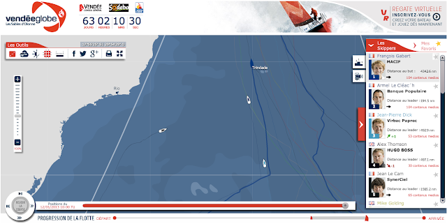
              14/01/2013 10:00 UTC situation
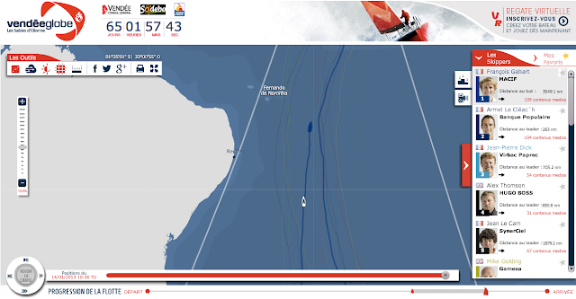
               >>> geolocalization with the Marine GeoGarage<<<

              From EyesofBrazil

              Fernando de Noronha is an archipelago in the Atlantic Ocean, part of the State of Pernambuco, around 354 km offshore from the Brazilian coast. Its area is 18.4 km2, its population 2,051 (as of the year 2000).
              The area is a special municipality (distrito estatal) of the Brazilian state of Pernambuco.

               >>> geolocalization with the Marine GeoGarage<<<

              The archipelago is named after the rich Portuguese merchant of the same name (although he was born Fernão de Noronha and has also been known as Fernão de Loronha).
              Under contract by the Portuguese Crown, Noronha sailed westward in search of pau-brasil (an in-demand wood with a distinctive red dye, from which Brazil gets it’s name).
              He and his crew of explorers ended up “extracting” aprox. 1,300 tons of this special wood and selling it in Lisbon at a mark-up of 400% to 500%.
              As a result of his successfully completed contract, King Manuel I handed the first captaincy of the sea to Noronha, which encompassed of the archipelago.
              Also of interest, is the fact that Noronha married off his daughter, Isabel de Castro, to the explorer Pedro Cabral, who “discovered” Brazil.

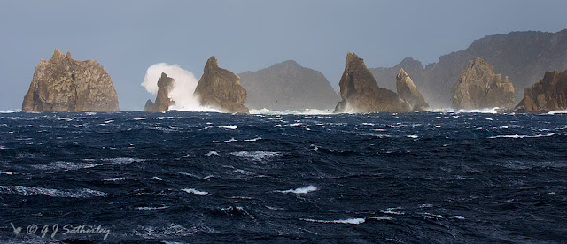
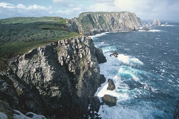
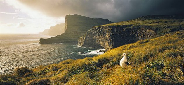
              Beach on Fernando de Noronha island :
               "The moment one says it is a moment of perfection, it is something less than perfection.
              So on the island of Fernando de Noronha, I will be quiet now.
              I will let the birds speak Portuguese.
              I will let the waters speak dialects of green.
              I will let the rocks tell me I was never really born; and the vistas carry my insights to an early death.
              I will let the breeze nudge my years off one cliff here and one cliff there.
              I will let the air confiscate my passport.
              And I will let the sand send my battles to the sea.
              Let them all simply make an island out of me.
              The moment I say I am lost without love, I will be something less than lost."
              Howard Altman poem ('In this House')

              Geology

              The islands of this archipelago are the visible parts of a range of submerged mountains.
              Consisting of 21 islands, islets and rocks of volcanic origin, the main island has an area of 18 km2, being 10 km long and 3.5 km at its maximum width.
              The base of this enormous volcanic formation is 756 m below the surface.

              The main island, from which the group gets its name, makes up 91% of the total area;
              the islands of Rata, Sela Gineta, Cabeluda and São Jose, together with the islets of Leão and Viúva make up the rest.
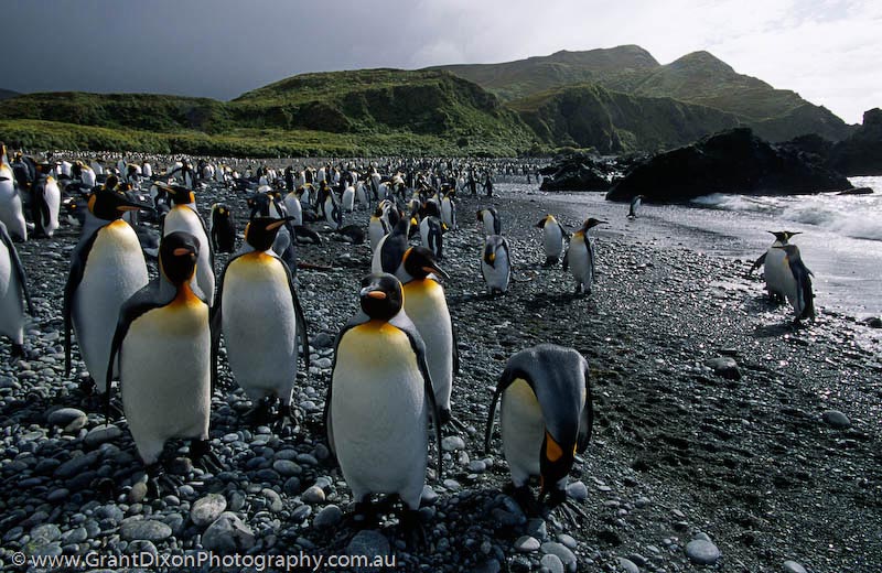
              Ecosystem

              The main attraction is the maritime flora and fauna; one can spot sea tortoises, dolphins, albatrosses, among many others.
              Fernando de Noronha is considered the best scuba diving place in Brazil.
              Warm water and exuberant sub aquatic fauna and flora can be found in dives from 25 to 40 m deep.
              A Brazilian warship, the corvette NaeL Ipiranga, sank in 1987 and is lying in pristine condition at around 190 feet.

              In and around Praia Sancho, is a reserve for some 600 spinner dolphins (photo)

              Nowadays, Fernando de Noronha’s economy depends on tourism, restricted by the limitations of its delicate ecosystem.
              In fact, there is an Environmental Protection Tax of roughly US$10/day just to visit the island which if I’m not mistaken must terminate (along with your stay) after a period of 30 days.
              In addition to the historical interest noted above, the archipelago has been the subject of the attention of various scientists dedicated to the study of its flora, fauna, geology, etc.

               >>> geolocalization with the Marine GeoGarage<<<
              In 2001, UNESCO declared Fernando de Noronha, with Rocas Atoll, a World Heritage Site.

              Colonial Prison

              Long before becoming the touristic and ecological paradise that it is today, the archipelago housed a prison which stood from 1737 until 1942.
              In the remaining years, starting from 1938, only political prisoners of the Estado Novo regime were sent there.
              A report from the magazine O Cruzeiro, from August 2nd, 1930, describes the prison as an infernal ghost for these people banished from society, that live completely distanced from what is happening in the rest of the world, in spite of the Government giving the prisoners a healthy life of work and comfort.

              Ecological Problems

              Although protected by the National Park designation, much of the land-based ecosystem is destroyed. The largest part of the original vegetation was cut down in an effort to stop prisoners from making rafts and escaping.
              There is also the problem of invasive species, especially the flax seeds, originally introduced to feed the roosters.
              It now is out of control and threatens the existing vegetation.
              Without the plants for cover, the islands can’t retain water during the dry season, so the vegetation turns brown as a consequence of drying out.
              Another invasive species is the lizard, locally known as teju, which was introduced to control the rat population.
              The idea, however didn’t work as the rats are nocturnal and the lizards aren’t, which has made the growing lizard population the more pressing problem.

              Detail from the 1502 Cantino planisphere, showing the island of "Quaresma"
              (Fernando de Noronha?) off the Brazilian coast

              History of Occupation

              Many controversies mark the archipelago’s discovery by Europeans.
              From its original name, Ilha da Quaresma (Lent Island), it was sighted by expeditions in the years 1501, 1502 and 1503.
              The Viscount of Santarém, however, attributed the discovery to Gaspar de Lemos, captain of the supply ship of Pedro Álvares Cabral’s fleet, sent back to Portugal with news of the discovery of Brazil.
              Modern historians, however, credit the 1501-1502 expedition led by Fernão de Noronha with the discovery of the archipelago.

               Philippe Buache, Paris, 1737 (BNF)

              The first to actually describe the island was Amerigo Vespucci, who travelled with a Portuguese expedition of Gonçalo Coelho to Brazil in the year 1503.
              In 1534, the Fernando de Noronha Archipelago was invaded by the English, and from 1556 until 1612, it was held by the French.
              In 1628, it was occupied by the Dutch, who were displaced two years later by a Spanish-Portuguese military expedition led by Rui Calaza Borges.

               English manuscript chart on paper of a bay on Fernando de Noronha.
              Many names in English, to the lower left.
              A rare example of a manuscript sea chart, probably from the Thames School, with intriguing early annotations, perhaps used in the offices of the British Navy. 
              This draft is extremely Erroneous.

              The Dutch occupied the island once again in 1635, making it a hospital for their troops who occupied Northeastern Brazil (the Brazilian coast between Rio São Francisco and Maranhão).
              The island became known as Pavonia, in honour of Michiel de Pauw, one of the directors of the Dutch West Indies Company.
              It would remain under Dutch control for nearly twenty years, when it was reconquered by Portugal.

              Finding it uninhabited and completely abandoned in 1736, the French East Indies Company took the island and renamed it Isle Dauphine.
              Only from 1737 on, after the expulsion of the French, Fernando de Noronha was definitively occupied by Portugal.
              This time it was decided to fortify the island.
              For this purpose, ten forts were built in all strategic points where a possibility of disembarkation existed; nine in the main island and one in the Ilha de São José situated in front of the Saint Anthony harbour.
              The forts were connected by a network of stone roads.
              This defense system was planned by the Portuguese military engineer Diogo da Silveira Veloso. Around 1770, the first permanent settlement, Vila dos Remédios, was founded.
              The village was divided in two units (pátios); in the superior one were the administrative buildings, in the lower one the church and the associated religious buildings.

              As Brazil became independent, very little changed for Fernando de Noronha.
              At the beginning of the 20th century, the British arrived to provide technical co-operation in telegraphy (The South American Company).
              Later the French came with the French Cable and the Italians with Intalcable.

               >>> geolocalization with the Marine GeoGarage<<<

              In 1942, during World War II, the archipelago was made a Federal Territory that also included Rocas Atoll and Saint Peter and Paul Rocks, and political and ordinary prisoners were sent to the local prison. In 1988 approximately 70% of the archipelago was declared a maritime national park, with the goal of preserving the land and sea environment.
              On October 5, 1988, the Federal Territory was dissolved and added to the state of Pernambuco (except Rocas Atoll, which was added to the state of Rio Grande do Norte).

              UK & misc. update in the Marine GeoGarage

              $
              0
              0
              Today 960 charts ( including sub-charts) from UKHO
              are available in the 'UK & misc.' chart layer
              regrouping charts for different countries :
              1. UK
              2. Argentina
              3. Belgium
              4. Netherlands
              5. Croatia
              6. Oman
              7. Portugal
              8. Spain
              9. Iceland
              10. South Africa
              11. Malta

              637 charts for UK
              (16    Jizan
              3048    Grand Port
              3287    Bonny River  Field Point to Ford Point
              4644    Southern Ocean, Cape Otway to Cape Howe including Tasmania

              so 4 charts withdrawn from previous update
              &
              3586    South Atlantic Ocean, Harbours and Anchorages in South Georgia
              so 1 chart added  from previous update)

              24 charts for Argentina :

              • 226    International Chart Series, Antarctica - South Shetlands Islands, Deception Island.
              • 227    Church Point to Cape Longing including James Ross Island
              • 531    Plans on the Coast of Argentina
              • 552    Plans on the Coast of Argentina
              • 557    Mar del Plata to Comodoro Rivadavia
              • 1302    Cabo Guardian to Punta Nava
              • 1331    Argentina, Approaches to Bahia Blanca
              • 1332    Isla de los Estados and Estrecho de le Maire
              • 1751    Puerto de Buenos Aires
              • 1982B    Rio Parana - Rosario to Parana
              • 2505    Approaches to the Falkland Islands
              • 2517    North-Western Approaches to the Falkland Islands
              • 2519    South-Western Approaches to the Falkland Islands
              • 3065    Punta Piedras to Quequen
              • 3066    Quequen to Rio Negro
              • 3067    Rio Negro to Isla Leones
              • 3106    Isla Leones to Pto San Julian
              • 3213    Plans in Graham Land
              • 3560    Gerlache Strait  Northern Part
              • 3566    Gerlache Strait  Southern Part
              • 3755    Bahia Blanca
              • 4063    Bellingshausen Sea to Valdivia
              • 4200    Rio de la Plata to Cabo de Hornos
              • 4207    Falkland Islands to Cabo Corrientes and Northeast Georgia Rise
              27 charts for Belgium& Nederlands :

              • 99 Entrances to Rivers in Guyana and Suriname
              • 110 Westkapelle to Stellendam and Maasvlakte
              • 112 Terschellinger Gronden to Harlingen
              • 120 Westerschelde - Vlissingen to Baalhoek and Gent - Terneuzen Canal
              • 122 Approaches to Europoort and Hoek van Holland
              • 124 Noordzeekanaal including Ijmuiden, Zaandam and Amsterdam
              • 125 North Sea Netherlands - Approaches to Scheveningen and Ijmuiden
              • 126 North Sea, Netherlands, Approaches to Den Helder
              • 128 Westerschelde, Valkenisse to Wintam
              • 207 Hoek Van Holland to Vlaardingen
              • 208 Rotterdam, Nieuwe Maas and Oude Maas
              • 209 Krimpen a/d Lek to Moerdijk
              • 266 North Sea Offshore Charts Sheet 11
              • 572 Essequibo River to Corentyn River
              • 702 Nederlandse Antillen, Aruba and Curacao
              • 1187 Outer Silver Pit
              • 1408 North Sea, Harwich and Rotterdam to Cromer and Terschelling.
              • 1412 Caribbean Sea - Nederlandse Antillen, Ports in Aruba and Curacao
              • 1414 Bonaire
              • 1503 Outer Dowsing to Smiths Knoll including Indefatigable Banks.
              • 1504 Cromer to Orford Ness
              • 1546 Zeegat van Texel and Den Helder Roads
              • 1630 West Hinder and Outer Gabbard to Vlissingen and Scheveningen
              • 1631 DW Routes to Ijmuiden and Texel
              • 1632 DW Routes and Friesland Junction to Vlieland
              • 1874 North Sea, Westerschelde, Oostende to Westkapelle
              • 2047 Approaches to Anguilla

              14 charts for Croatia :

              • 201 Rt Kamenjak to Novigrad
              • 202 Kvarner, Kvarneric and Velebitski Kanal
              • 269 Ploce and Split with Adjacent Harbours, Channels and Anchorages
              • 515 Zadar to Luka Mali Losinj
              • 683 Bar, Dubrovnik and Approaches and Peljeski Kanal
              • 1574 Otok Glavat to Ploce and Makarska
              • 1580 Otocic Veliki Skolj to Otocic Glavat
              • 1582 Approaches to Bar and Boka Kotorska
              • 1996 Ports in Rijecki Zaljev
              • 2711 Rogoznica to Zadar
              • 2712 Otok Susac to Split
              • 2719 Rt Marlera to Senj including Approaches to Rijeka
              • 2773 Sibenik, Pasmanski Kanal, Luka Telascica, Sedmovrace, Rijeka Krka
              • 2774 Otok Vis to Sibenik
               5 charts forOman :

              • 2851 Masirah to the Strait of Hormuz    withdrawn from last update
              • 2854 Northern approaches to Masirah
              • 3171 Southern Approaches to the Strait of Hormuz
              • 3409 Plans in Iran, Oman and the United Arab Emirates
              • 3511 Wudam and Approaches
              • 3518 Ports and Anchorages on the North East Coast of Oman


              123 charts for Spain& Portugal :

              • 73 Puerto de Huelva and Approaches
              • 83 Ports on the South Coast of Portugal
              • 85 Spain - south west coast, Rio Guadalquivir
              • 86 Bahia de Cadiz
              • 87 Cabo Finisterre to the Strait of Gibraltar
              • 88 Cadiz
              • 89 Cabo de Sao Vicente to Faro
              • 91 Cabo de Sao Vicente to the Strait of Gibraltar
              • 93 Cabo de Santa Maria to Cabo Trafalgar
              • 142 Strait of Gibraltar
              • 144 Mediterranean Sea, Gibraltar
              • 307 Angola, Cabeca da Cobra to Cabo Ledo
              • 308 Angola, Cabo Ledo to Lobito
              • 309 Lobito to Ponta Grossa
              • 312 Luanda to Baia dos Tigres
              • 366 Arquipelago de Cabo Verde
              • 369 Plans in the Arquipelago de Cabo Verde    withdrawn from last update
              • 469 Alicante
              • 473 Approaches to Alicante
              • 518 Spain East Coast, Approaches to Valencia
              • 562 Mediterranean Sea, Spain - East Coast Valencia
              • 580 Al Hoceima, Melilla and Port Nador with Approaches
              • 659 Angola, Port of Soyo and Approache
              • 690 Cabo Delgado to Mikindani Bay
              • 886 Estrecho de la Bocayna and Approaches to Arrecife
              • 1094 Rias de Ferrol, Ares, Betanzos and La Coruna
              • 1096 Ribadeo
              • 1110 La Coruna and Approaches
              • 1111 Punta de la Estaca de Bares to Cabo Finisterre
              • 1113 Harbours on the North-West Coast of Spain
              • 1117 Puerto de Ferrol
              • 1118 Ria de Ferrol
              • 1122 Ports on the North Coast of Spain
              • 1133 Ports on the Western Part of the North Coast of Spain
              • 1142 Ria de Aviles
              • 1145 Spain - North Coast, Santander
              • 1150 Ports on the North Coast of Spain
              • 1153 Approaches to Gijon
              • 1154 Spain, north coast, Gijon
              • 1157 Pasaia (Pasajes) and Approaches
              • 1172 Puertos de Bermeo and Mundaka
              • 1173 Spain - North Coast, Bilbao
              • 1174 Approaches to Bilbao
              • 1180 Barcelona
              • 1189 Approaches to Cartagena
              • 1193 Spain - east coast, Tarragona
              • 1194 Cartagena
              • 1196 Approaches to Barcelona
              • 1197 Plans on the West Coast of Africa
              • 1215 Plans on the Coast of Angola
              • 1216 Baia dos Tigres
              • 1290 Cabo de San Lorenzo to Cabo Ortegal
              • 1291 Santona to Gijon
              • 1448 Gibraltar Bay
              • 1453 Gandia
              • 1455 Algeciras
              • 1460 Sagunto
              • 1514 Spain - East Coast, Castellon
              • 1515 Ports on the East Coast of Spain
              • 1589 Almeria
              • 1595 Ilhas do Principe, de Sao Tome and Isla Pagalu
              • 1684 Ilha da Madeira, Manchico and Canical
              • 1685 Nisis Venetico to Nisos Spetsai including the Channels between Akra Maleas and Kriti
              • 1689 Ports in the Arquipelago da Madeira
              • 1701 Cabo de San Antonio to Vilanova I la Geltru including Islas de Ibiza and Formentera
              • 1703 Mallorca and Menorca
              • 1704 Punta de la Bana to Islas Medas
              • 1724 Canal do Geba and Bissau
              • 1726 Approaches to Canal do Geba and Rio Cacheu
              • 1727 Bolama and Approaches
              • 1730 Spain - West Coast, Ria de Vigo
              • 1731 Vigo
              • 1732 Spain - West Coast, Ria de Pontevedra
              • 1733 Spain - West Coast, Marin and Pontevedra
              • 1734 Approaches to Ria de Arousa
              • 1740 Livingston Island, Bond Point to Brunow Bay including Juan Carlos 1 Base and Half Moon Island
              • 1755 Plans in Ria de Arousa
              • 1756 Ria de Muros
              • 1762 Vilagarcia de Arosa
              • 1764 Ria de Arousa
              • 1831 Arquipelago da Madeira
              • 1847 Santa Cruz de Tenerife
              • 1850 Approaches to Malaga
              • 1851 Malaga
              • 1854 Motril and Adra
              • 1856 Approaches to Puerto de La Luz (Las Palmas)
              • 1858 Approaches to Santa Cruz de Tenerife, Puerto de San Sebastian de la Gomera, Santa Cruz de la Palma and Approaches
              • 1869 Gran Canaria to Hierro
              • 1870 Lanzarote to Gran Canaria
              • 1895 Ilha de Sao Miguel
              • 1950 Arquipelago dos Acores
              • 1956 Arquipelago dos Acores Central Group
              • 1957 Harbours in the Arquipelago Dos Acores (Central Group)
              • 1959 Flores,Corvo and Santa Maria with Banco Das Formigas
              • 2742 Cueta
              • 2761 Menorca
              • 2762 Menorca, Mahon
              • 2831 Punta Salinas to Cabo de Formentor including Canal de Menorca
              • 2832 Punta Salinas to Punta Beca including Isla de Cabrera
              • 2834 Ibiza and Formentera
              • 2932 Cabo de Sao Sebastiao to Beira
              • 2934 Africa - east coast, Mozambique, Beira to Rio Zambeze
              • 2935 Quelimane to Ilha Epidendron
              • 3034 Approaches to Palma
              • 3035 Palma
              • 3220 Entrance to Rio Tejo including Baia de Cascais
              • 3221 Lisboa, Paco de Arcos to Terreiro do Trigo
              • 3222 Lisboa, Alcantara to Canal do Montijo
              • 3224 Approaches to Sines
              • 3227 Aveiro and Approaches
              • 3228 Approaches to Figueira da Foz
              • 3257 Viana do Castelo and Approaches
              • 3258 Approaches to Leixoes and Barra do Rio Douro
              • 3259 Approaches to Setubal
              • 3260 Carraca to Ilha do Cavalo
              • 3448 Plans in Angola
              • 3578 Eastern Approaches to the Strait of Gibraltar
              • 3633 Islas Sisargas to Montedor
              • 3634 Montedor to Cabo Mondego
              • 3635 Cabo Mondego to Cabo Espichel
              • 3636 Cabo Espichel to Cabo de Sao Vicente
              • 3764 Cabo Torinana to Punta Carreiro
              • 4114 Arquipelago dos Acores to Flemish Cap
              • 4115 Arquipelago dos Acores to the Arquipelago de Cabo Verde
              • Ilha de Madeira, Ponta Gorda de Sao Lourenco including the Port of Funchal


              14 charts for Iceland :

              • 2733 Dyrholaey to Snaefellsjokull
              • 2734 Approaches to Reykjavik
              • 2735 Iceland - South West Coast, Reykjavik
              • 2897 Iceland
              • 2898 Vestfirdir
              • 2899 Iceland, Noth Coast, Horn to Rauoinupur
              • 2900 Iceland, North East Coast, Rauoinupur to Glettinganes
              • 2901 Iceland, East Coast, Glettinganes to Stokksnes
              • 2902 Stokksnes to Dyrholaey
              • 2955 Iceland, North Coast, Akureyri
              • 2956 Iceland, North Coast, Eyjafjordur
              • 2937 Hlada to Glettinganes
              • 2938 Reydarfjordur
              • 4112 North Atlantic Ocean, Iceland to Greenland


              50 charts for South Africa :

              • 578 Cape Columbine to Cape Seal
              • 632 Hollandsbird Island to Cape Columbine
              • 643 Durban Harbour
              • 665 Approaches to Zanzibar
              • 1236 Saldanha Bay
              • 1769 Islands and Anchorages in the South Atlantic Ocean
              • 1806 Baia dos Tigres to Conception Bay
              • 1846 Table Bay Docks and Approaches
              • 1922 RSA - Simon's Bay
              • 2078 Port Nolloth to Island Point
              • 2086 East London to Port S Johns
              • 2087 Port St John's to Durban
              • 2088 Durban to Cape Vidal
              • 2095 Cape St Blaize to Port S. John's
              • 3793 Shixini Point to Port S Johns
              • 3794 Port S Johns to Port Shepstone
              • 3795 Port Shepstone to Cooper Light
              • 3797 Green Point to Tongaat Bluff
              • 3859 Cape Cross to Conception Bay
              • 3860 Mutzel Bay to Spencer Bay
              • 3861 Namibia, Approaches to Luderitz
              • 3869 Hottentot Point to Chamais Bay
              • 3870 Chamais Bay to Port Nolloth
              • 4132 Kunene River to Sand Table Hill
              • 4133 Sand Table Hill to Cape Cross
              • 4136 Harbours on the West Coasts of Namibia and South Africa
              • 4141 Island Point to Cape Deseada
              • 4142 Saldanha Bay Harbour
              • 4145 Approaches to Saldanha Bay
              • 4146 Cape Columbine to Table Bay
              • 4148 Approaches to Table Bay
              • 4150 Republic of South Africa, South West Coast, Table Bay to Valsbaai
              • 4151 Cape Deseada to Table Bay
              • 4152 Republic of South Africa, South West Coast, Table Bay to Cape Agulhas
              • 4153 Republic of South Africa, South Coast, Cape Agulhas to Cape St. Blaize
              • 4154 Mossel Bay
              • 4155 Cape St Blaize to Cape St Francis
              • 4156 South Africa, Cape St Francis to Great Fish Point
              • 4157 South Africa, Approaches to Port Elizabeth
              • 4158 Republic of South Africa - South Coast, Plans in Algoa Bay.
              • 4159 Great Fish Point to Mbashe Point
              • 4160 Ngqura Harbour
              • 4162 Approaches to East London
              • 4163 Republic of South Africa, South East Coast, Mbashe Point to Port Shepstone     NEW
              • 4170 Approaches to Durban
              • 4172 Tugela River to Ponta do Ouro
              • 4173 Approaches to Richards Bay
              • 4174 Richards Bay Harbour
              • 4205 Agulhas Plateau to Discovery Seamounts
              • 4700 Port Elizabeth to Mauritius


                5 charts for Malta :

                • 36 Marsaxlokk
                • 177 Valletta Harbours
                • 211 Plans in the Maltese Islands
                • 2537 Ghawdex (Gozo), Kemmuna (Comino) and the Northern Part of Malta
                • 2538 Malta

                61 international charts from NGA 
                (3 charts withdrawn from previous update
                2889 Dubayy to Jabal Az Zannah and Jazirat Das
                3172 Strait of Hormuz
                 3174 Western Approaches to the Strait of Hormuz)


                • 3 Chagos Archipelago
                • 82 Outer Approaches to Port Sudan
                • 100 Raas Caseyr to Suqutra
                • 255 Eastern Approaches to Jamaica
                • 256 Western Approaches to Jamaica
                • 260 Pedro Bank to the South Coast of Jamaica
                • 333 Offshore Installations in the Gulf of Suez
                • 334 North Atlantic Ocean, Bermuda
                • 386 Yadua Island to Yaqaga Island
                • 390 Bahamas, Grand Bahama Island, Approaches to Freeport
                • 398 Grand Bahama Island, Freeport Roads, Freeport Harbour
                • 457 Portland Bight
                • 462 The Cayman Islands
                • 486 Jamaica and the Pedro Bank
                • 501 South East Approaches to Trinidad
                • 666 Port Mombasa including Port Kilindini and Port Reitz
                • 700 Maiana to Marakei
                • 766 Ellice Islands
                • 868 Eastern and Western Approaches to The Narrows including Murray's Anchorage
                • 920 Chagos Archipelago, Diego Garcia
                • 928 Sulu Archipelago
                • 959 Colson Point to Belize City including Lighthouse Reef and Turneffe Islands
                • 1043 Saint Lucia to Grenada and Barbados
                • 1225 Gulf of Campeche
                • 1265 Approaches to Shatt Al 'Arab or Arvand Rud, Khawr Al Amaya and Khawr Al Kafka
                • 1450 Turks and Caicos Islands, Turks Island Passage and Mouchoir Passage
                • 1638 Plans in Northern Vanuatu
                • 2006 West Indies, Virgin Islands, Anegada to Saint Thomas
                • 2009 Sheet 2 From 23 deg 40 min North Latitude to Old Bahama Channel
                • 2065 Northern Antigua
                • 2133 Approaches to Suez Bay (Bahr el Qulzum)
                • 2373 Bahr el Qulzum (Suez Bay) to Ras Sheratib
                • 2374 Ra's Sharatib to Juzur Ashrafi
                • 2441 Jazireh-ye Tonb-e Bozorg to Jazireh-ye Forur
                • 2658 Outer Approaches to Mina` al Jeddah (Jiddah)
                • 2837 Strait of Hormuz to Qatar
                • 2847 Qatar to Shatt al `Arab
                • 2887 Dubai (Dubayy) and Jazireh-Ye Qeshm to Jazirat Halul
                • 2888 Jask to Dubayy and Jazireh-ye Qeshm
                • 3043 Red Sea, Ports on the coast of Egypt.
                • 3102 Takoradi and Sekondi Bays
                • 3175 Jazirat al Hamra' to Dubai (Dubayy) and Jazireh-ye Sirri
                • 3179 UAE and Qatar, Jazirat Das to Ar Ru' Ays
                • 3310 Africa - east coast, Mafia Island to Pemba Island
                • 3361 Wasin Island to Malindi
                • 3432 Saltpond to Tema
                • 3493 Red Sea - Sudan, Bashayer Oil Terminals and Approaches.
                • 3519 Southern Approaches to Masirah
                • 3520 Khawr Kalba and Dawhat Diba to Gahha Shoal
                • 3522 Approaches to Masqat and Mina' al Fahl
                • 3530 Approaches to Berbera
                • 3709 Gulf of Oman, United Arab Emirates, Port of Fujairah (Fujayrah) and Offshore Terminals.
                • 3723 Gulf of Oman, United Arab Emirates, Approaches to Khawr Fakkan and Fujairah (Fujayrah).
                • 3785 Mina' Raysut to Al Masirah
                • 3907 Bahama Islands and Hispaniola, Passages between Mayaguana Island and Turks and Caicos Islands.
                • 3908 Passages between Turks and Caicos Islands and Dominican Republic
                • 3910 Little Bahama Bank including North West Providence Channel
                • 3912 Bahamas, North East Providence Channel and Tongue of the Ocean
                • 3913 Bahamas, Crooked Island Passage and Exuma Sound
                • 3914 Turks and Caicos Islands and Bahamas, Caicos Passage and Mayaguana Passage
                • 3951 Sir Bani Yas to Khawr al `Udayd

                Don't forget to visit the UKHO Notices to Mariners : NTM for 2013

                So today, for a cost of 9.9 € / month ('Premium Charts' subscription), you can have access to 2588 additional updated charts (4332 including sub-charts) coming from 3 international Hydrographic Services (UKHO, CHS, AHS and France).

              Canada CHS update in the Marine GeoGarage

              $
              0
              0

              16charts have been updated (December 28, 2012) :
                • 1202 CAP ETERNITE TO SAINT-FULGENCE
                • 1203 TADOUSSAC TO CAP ETERNITE
                • 1429 CANAL DE LA RIVE SUD
                • 1430 LAC SAINT-LOUIS
                • 3000 JUAN DE FUCA STRAIT TO DIXON ENTRANCE
                • 3461 JUAN DE FUCA STRAIT EASTERN PORTION
                • 3462 JUAN DE FUCA STRAIT TO STRAIT OF GEORGIA
                • 3891 SKIDEGATE CHANNEL
                • 3955 PLANS PRINCE RUPERT HARBOUR
                • 4023 NORTHUMBERLAND STRAIT
                • 4049 GRAND BANK NORTHERN PORTION TO FLEMISH PASS
                • 4406 TRYON SHOALS TO CAPE EGMONT
                • 4498 PUGWASH HARBOUR AND APPROACHES
                • 4921 PLANS CHALEUR BAY -NORTH SHORE
                • 4955 HAVRE-AUX-MAISONS
                • 6248 OBSERVATION POINT TO GRINDSTONE POINT
                  So 688charts (1658 including sub-charts) are available in the Canada CHS layer. (see coverage)

                  Note : don't forget to visit 'Notices to Mariners' published monthly and available from the Canadian Coast Guard both online or through a free hardcopy subscription service.
                  This essential publication provides the latest information on changes to the aids to navigation system, as well as updates from CHS regarding CHS charts and publications.
                  See also written Notices to Shipping and Navarea warnings : NOTSHIP
                  Viewing all 497 articles
                  Browse latest View live


                  <script src="https://jsc.adskeeper.com/r/s/rssing.com.1596347.js" async> </script>